Geospatial Data
Satellite Image Labeling in Disaster Recovery and Humanitarian Aid
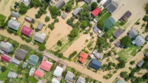
Disasters can have devastating effects on communities, ecosystems, and economies. In the wake of such events, timely and accurate information is essential for effective disaster recovery and humanitarian aid efforts.