Satellite image analysis is essential in industries such as agriculture, urban planning, and disaster management, providing valuable data for decision-making and practical uses for consumers.
The space age began with the launch of Sputnik 1 by the Soviet Union, marking the first human-made object to orbit Earth. Although it did not carry cameras, it paved the way for future satellite technology.
The United States launched Explorer 6 in 1959, which took the first image of Earth from space, a blurry but groundbreaking photo showing sunlight reflected off cloud cover over the Pacific Ocean.
From the launch of Sputnik 1 in 1957 to today’s advanced imaging satellites, the history of satellite images tracks a journey from simple orbits to high-resolution Earth observation. This evolution has revolutionized fields like weather forecasting, environmental monitoring, and national security, marking each milestone with increased precision and application diversity.
The replica of Sputnik 1 - the world's first artificial satellite. Picture by Andrew Butko, CC BY-SA 3.0.
Applications Across Industries
In agriculture, satellite image analysis is used for precision farming, allowing farmers to monitor crop health, soil conditions, and weather patterns. By analyzing these images, farmers can optimize irrigation, apply fertilizers more efficiently, and detect pest infestations early, ultimately improving crop yields and reducing costs.
Urban planners use satellite imagery to monitor urban sprawl, manage land use, and plan infrastructure development. High-resolution images help in mapping cities, analyzing traffic patterns, and assessing the impact of construction projects. This data supports sustainable development and efficient resource allocation.
Satellite images play a crucial role in tracking environmental changes, such as deforestation, desertification, and melting ice caps. Environmental agencies and researchers use this data to study climate change impacts, manage natural resources, and protect endangered ecosystems. Regular monitoring helps in formulating effective conservation strategies.
An illustration of Axelspace's GRUS constellation, consisting of microsatellites used for Earth observation. GRUS supports applications like predicting agricultural yields and assessing disaster damage, benefiting clients such as banks making informed loan decisions. Source: japan.go.jp
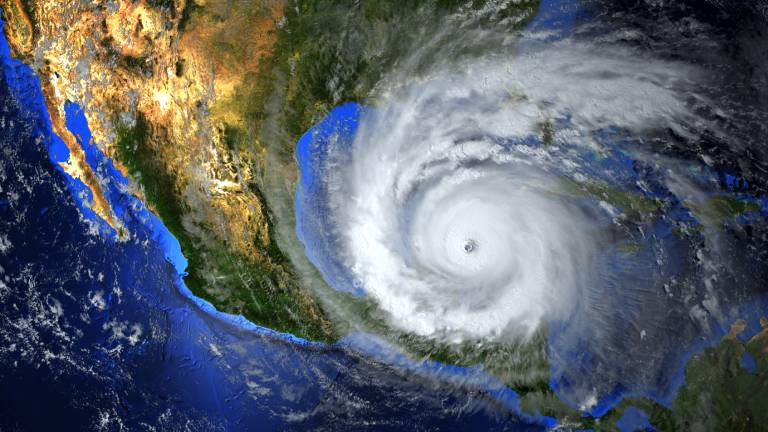
During natural disasters like hurricanes, earthquakes, and floods, satellite image analysis provides real-time information on affected areas. Emergency responders and relief agencies use this data to assess damage, plan rescue operations, and distribute aid efficiently. Post-disaster, these images help in recovery and rebuilding efforts.
The oil and gas industry uses satellite imagery for exploration and monitoring. It helps in identifying potential drilling sites, monitoring pipelines, and detecting oil spills. By analyzing these images, companies can enhance operational efficiency and minimize environmental impacts.
Military and intelligence agencies rely on satellite image analysis for surveillance, reconnaissance, and mission planning. High-resolution images provide detailed information on enemy positions, infrastructure, and movements, aiding in strategic decision-making and national security.
Satellite imagery of Tokyo's Chuo City, demonstrating how satellite image analysis supports urban planners in monitoring city growth, planning infrastructure, and managing environmental factors. Source: arcgis.com
Common Uses for Consumers
Everyday consumers can also utilize free satellite data for various purposes. For instance, amateur astronomers can track celestial events, while hikers and outdoor enthusiasts use it for navigation and exploring new trails. Environmental enthusiasts can monitor local changes in land use and natural resources.
Teachers and students use satellite image analysis in educational projects to study geography, environmental science, and climate change. Access to real-time and historical images enhances learning experiences and fosters a deeper understanding of the world.
Potential homebuyers and real estate agents use satellite images to view properties and neighborhoods from above. This helps in assessing the surroundings, proximity to amenities, and potential land issues.
Free satellite data offers practical benefits to consumers, enhancing daily life and expanding knowledge. As technology advances, the accessibility and utility of satellite imagery will only continue to grow, opening new avenues for innovation and discovery.
DeeLab specializes in providing comprehensive data services to help businesses thrive in the digital age. Our expertise spans across precise data annotation, efficient document processing, and insightful web research. We are committed to delivering high-quality solutions tailored to meet the unique needs of each client.