Geospatial data links objects to specific locations on Earth, crucial for urban planning, environmental management, navigation, and autonomous systems. But what is geospatial data annotation, who needs it, and what types of data are involved?
Labeling Elements in Spatial Datasets
Geospatial data annotation is the process of labeling and tagging elements within spatial datasets. This often involves identifying and classifying objects or areas on satellite images, aerial photographs, and other types of geospatial data. The goal is to make this data readable and usable for artificial intelligence (AI) models and algorithms. These models can then process the information to analyze environments, monitor changes, or make predictions.
Annotation types may include labeling geographic features such as roads, buildings, water bodies, forests, or even smaller elements like streetlights and road signs. Other annotations involve demarcating boundaries, adding semantic meaning to landscapes, or tracking changes over time for temporal analysis. High-quality annotations help ensure that AI models can make sense of these vast datasets and generate actionable insights.

Satellite Image Analysis
Satellite image analysis is essential in industries such as agriculture, urban planning, and disaster management, providing valuable data for decision-making and practical uses for consumers.
Industries Relying on Geospatial Data Annotation
The scope of geospatial data annotation spans several industries. Here’s a closer look at some of the key sectors:
Autonomous Vehicles Self-driving car technology heavily relies on geospatial data annotation. Autonomous vehicles must accurately perceive their surroundings, including roads, pedestrians, and obstacles. Annotating detailed maps and real-time sensor data ensures that AI systems in vehicles can navigate safely and effectively.
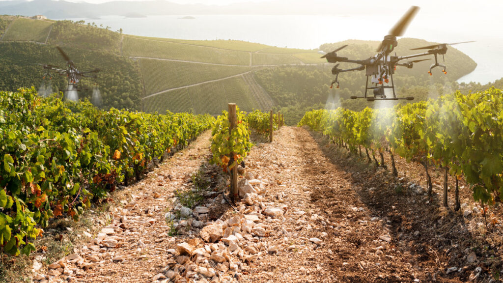
Agriculture Precision agriculture is another area where geospatial data annotation has become essential. Farmers and agronomists use annotated satellite or drone imagery to monitor crop health, soil conditions, and water levels. These insights help optimize agricultural practices and improve crop yields.
Telecommunications and Utilities Companies in the telecommunications and energy sectors use geospatial data to map networks, identify service coverage gaps, and plan infrastructure expansions. For example, annotating power lines, cell towers, or underground pipelines can assist in maintenance, expansion, or disaster recovery efforts.

What Types of Data Are Used in Geospatial Projects?
Geospatial data annotation projects typically involve a wide range of imagery and datasets. Some common sources include:
Satellite Imagery
High-resolution images captured by satellites provide an expansive view of the Earth’s surface. These images are essential for projects focused on urban planning, environmental monitoring, and defense. Satellite images can be annotated to identify buildings, roads, forests, bodies of water, and even changes over time.Aerial Photographs
Images taken from aircraft or drones provide a more detailed and closer view than satellite imagery. Aerial photographs are often used in agriculture, construction planning, or disaster response. Drone footage in particular can be annotated to track real-time changes in environments, crops, or infrastructure.LiDAR Data
Light Detection and Ranging (LiDAR) uses laser pulses to measure distances and create detailed 3D maps of environments. LiDAR is essential for autonomous vehicle development and urban planning, allowing systems to understand the structure and layout of surroundings. Annotating LiDAR data helps detect obstacles, measure heights, and map terrains with high accuracy.Topographic Maps
These maps provide detailed information about the elevation and contours of landscapes. In environmental monitoring or civil engineering, annotated topographic maps can be used to analyze land formations, flood risks, or construction viability.Multispectral and Hyperspectral Imagery
Multispectral and hyperspectral sensors capture data across multiple wavelengths of light, beyond what the human eye can see. This data is particularly useful in agriculture and environmental studies, where it can be annotated to identify plant health, water quality, or pollution levels.Street-Level Imagery
Images from street-level cameras, like those used in navigation apps, provide ground-level views of infrastructure, road signs, or pedestrian pathways. These are essential in training AI systems for autonomous vehicles and smart city solutions, where highly detailed labeling is needed.

Challenges in Geospatial Data Annotation
Geospatial data annotation is a complex and time-consuming task due to the sheer size and variety of datasets involved. Satellite images can cover vast areas, while aerial photographs and LiDAR data require intricate labeling to maintain accuracy. Some common challenges include:
- Scalability: Handling and annotating large volumes of high-resolution geospatial data.
- Accuracy: Ensuring precise labels, especially in cluttered environments or with overlapping objects.
- Temporal Changes: Continuously updating annotations to reflect environmental changes or urban development over time.
Despite these challenges, advances in AI and machine learning are making the annotation process more efficient and scalable. Tools like automated labeling algorithms and cloud-based platforms are helping to streamline the process while maintaining high levels of accuracy.